five-one-oh
Living local, urban design, sustainability, landscape architecture, and places in the East Bay. Design that works where it is.
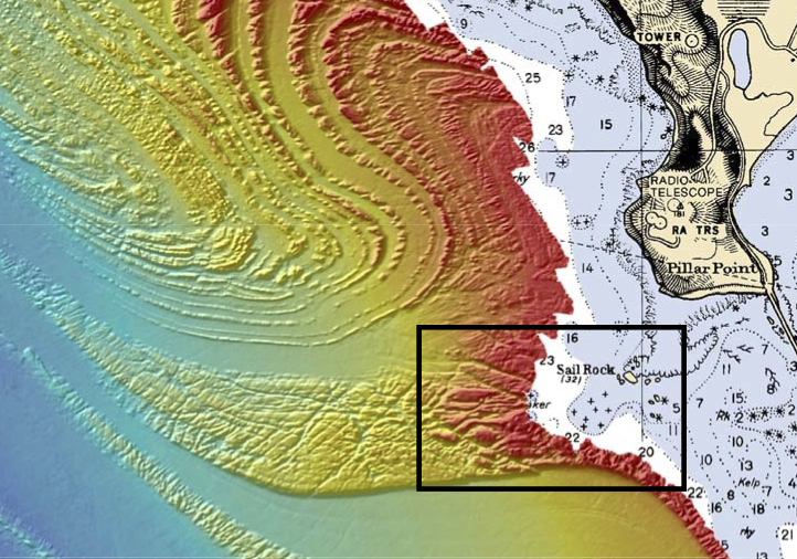
Mavericks_bathymetry_-_cropped
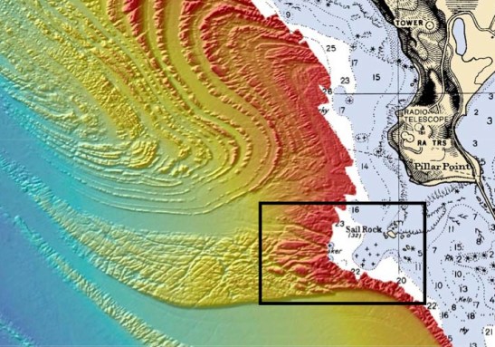
This Seafloor Map released by the US National Oceanic and Atmospheric Administration shows the geology behind Mavericks.
